Rick’s Posts

Back to Texas – Part 11

Final Days: March 1 & 2

It was cold and drizzling when we woke up on Friday, but we had both slept well. After breakfast, we each had a shower; the comfort station was toasty warm, and the water was hot, though the design of the shower stalls was not good, no place to put soap or shampoo bottle except on the floor.

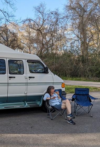
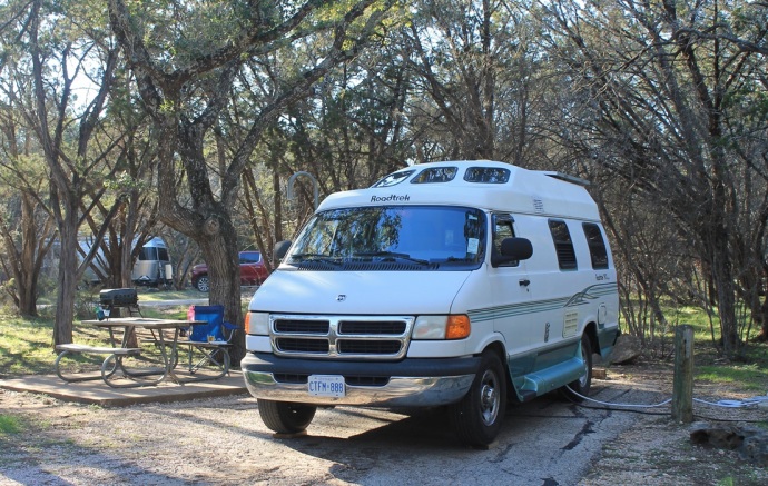
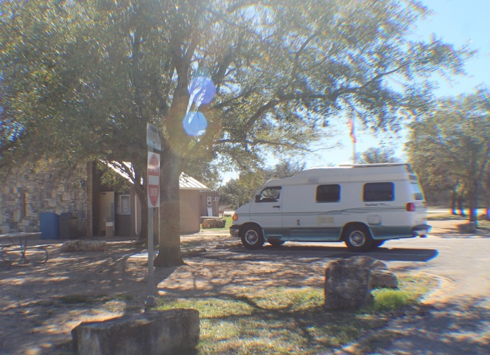
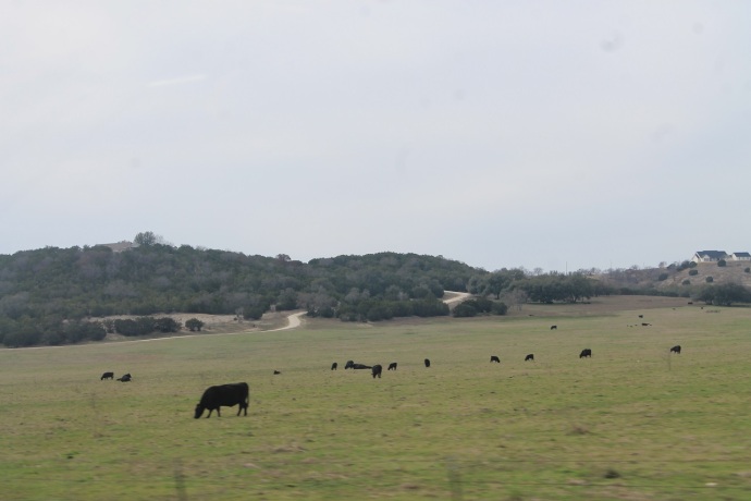
On our last Texas trip, we winterized the van here at Montgomery Bell because it was going to be really cold up in Ohio and Ontario. But this time, the temperature would be only around zero overnight in Ohio, then even warmer when we got home. So, after packing up, we simply added some fresh water to our tank, then went and dumped our waste water. We were on the road by 9.

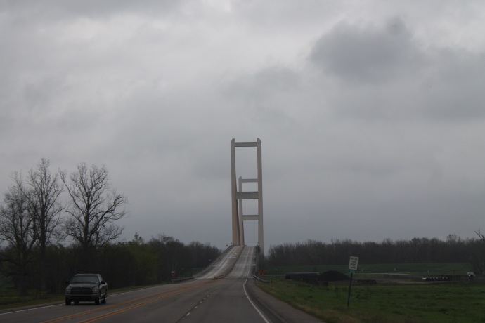
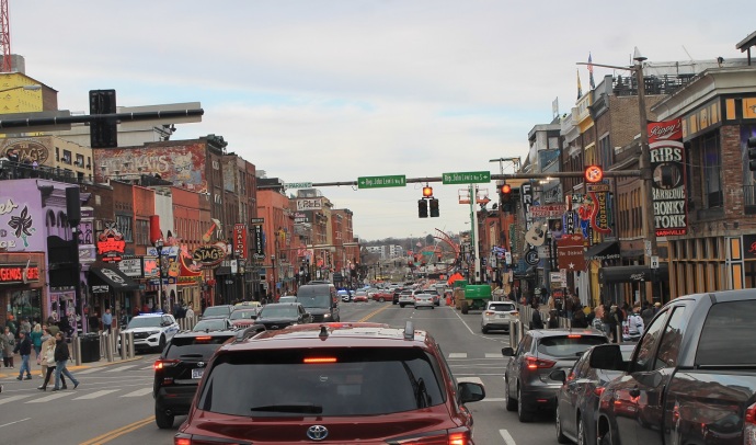
Two years ago, when we left this park, we went back down to the I-40 and through Nashville to pick up the I-65 north, but we’d run into construction and heavy morning rush-hour traffic, and it took us hours. So this time, I decided we’d cut northeast from the town of White Bluff on secondary roads and catch the I-65 well north of Music City. Google Maps showed similar times for the two routes, and this way, we’d have interesting (and new) scenery and a more restful drive.

Highway 250 out of White Bluff is a narrow, winding, hilly road that would definitely have been more fun in our MGB sports car, but Fred took it all in stride. The remainder of the route was on slightly better roads, but was still very scenic. We passed through the towns of Ashland City, Pleasant View, and Springfield and got on the Interstate at White House. About 15 miles further, we crossed into Kentucky just south of Franklin (every state seems to have a Franklin).

At the turn-off to Horse Cave, we went to a Love’s truck stop to fill the propane tank. The (not-very-accurate) gauge in the van showed that we were somewhere between empty and a third of a tank, lower than we’d ever seen it. Since it was going to be pretty cold that night and we’d have to use propane for the furnace, the fridge, and hot water, I didn’t want to risk running out.

The guy who came out to serve us asked, “Where y’all from in Canada? You ever seen a moose around there?”

“We’re from Kitchener, near Toronto,” I said, “and, yeah, I’ve seen moose, but further up north, not anywhere near where we live.”

“Well, ya ever eat moose? Is it like beef or deer or what? Y’all like it?”

“It’s sort of like beef, but wilder, gamier. And, yeah, it’s OK.”

“My daughter wants to go up to Canada to hunt moose. She’s only 14, and she’s shot lots of deer, but she’d like to get a moose. I hate deer meat. Y’all like it? I give most of the deer she shoots to the Amish. So what’s your president…or premier or whatever…what’s he like? I mean like does he run your country good? You like him? So, do y’all have, like, Republicans and Democrats, or what?”

“Um, we call him the Prime Minister, and he does OK, but he’s a bit wishy-washy, some of the stuff he does is fine, but…. Well, he’s a Liberal, which is sorta like your Democrats, and there’s the Conservatives, who are like your Republicans, but then we have a third party, the New Democrats, who are left of the Liberals….”

“Ah, I bet y’all’re with those guys, am I right? Hey, do you think I talk funny. All these Canadians come down here and tell me I talk funny, but I don’t hear it. What d’y’all think?”

“Well, you definitely have an accent, to my ear, but there’s nothing funny about it. You don’t hear it because you grew up with it, it’s what you know. You probably think I talk a bit different too, right?”

“Like you say ‘eh’ and stuff, right? What’s that mean anyway, something like ‘hunh,’ hunh?”

It went on like this long after he filled the tank (“What, that’s all y’all need?”) and filled out the paper work. Finally, “Y’all have a great day, hunh, and safe drivin’!” and he was off to talk to somebody else.

I think it might have been the most interesting talk I’d had with an American on the whole journey. When I got into the van, Sande, who’d been listening to it all, was laughing her head off and telling me what I should have said in response to his political questions.

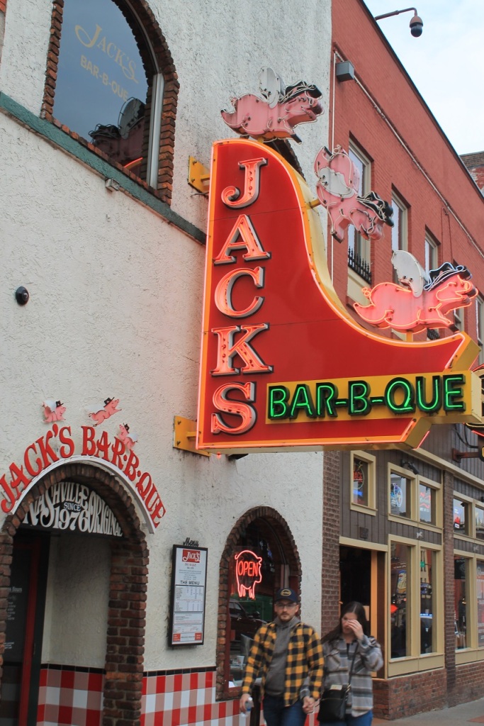
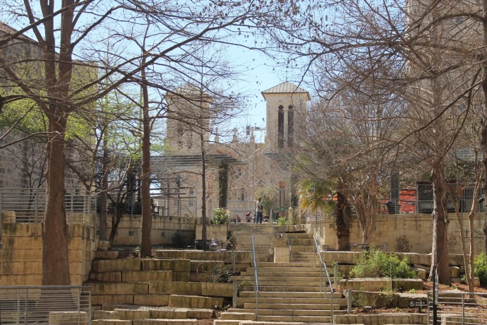
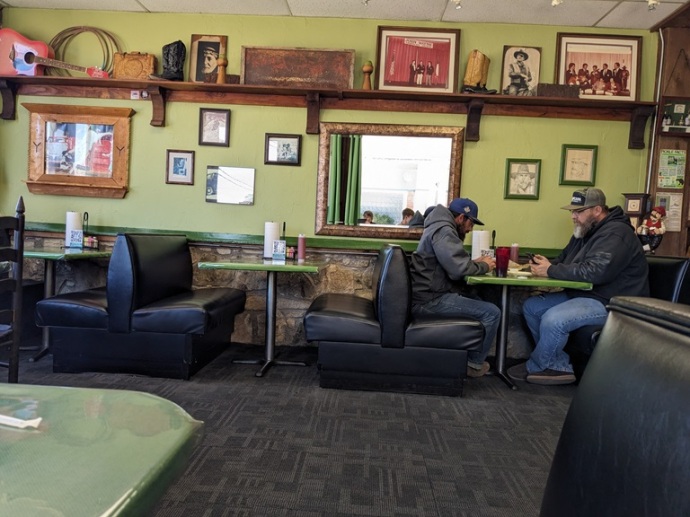
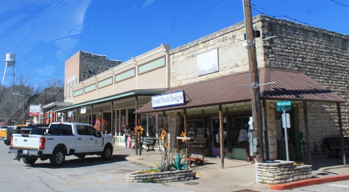
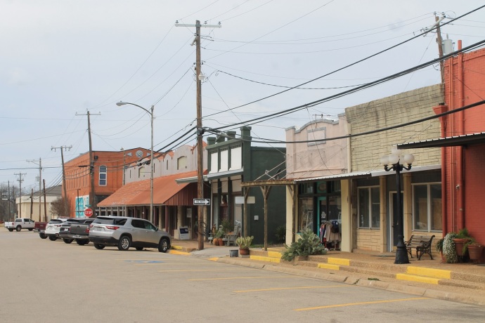
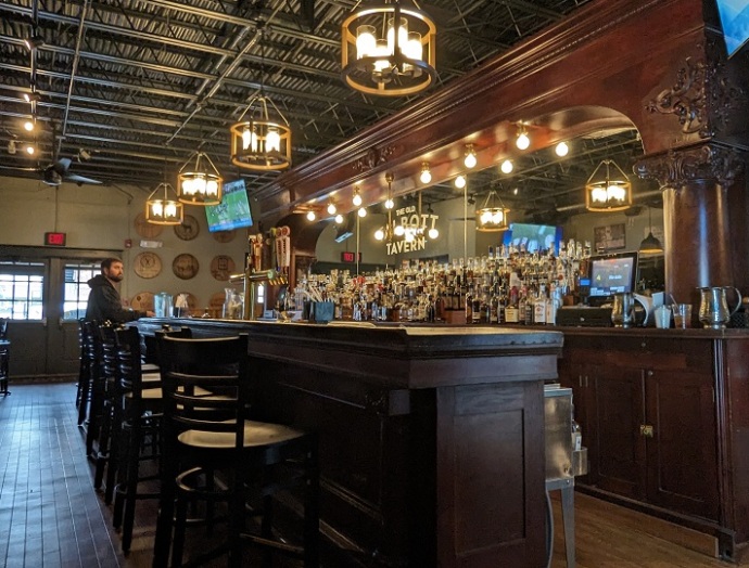
About 20 miles up the road, at Elizabethtown, we turned off on US-62 and went to Bardstown for lunch at the Talbott Tavern. Anytime we’re within a hundred miles of this place, we try to make this detour, and we were in no hurry today. Bardstown is the bourbon capital of the world, with several distilleries including Heaven Hill (the country’s largest) right in town and Jim Beam just a few miles away in Clermont (we’d visited both these places in 2016).

And the Talbott, one of our favourite pubs anywhere, is a wonderful old place that’s been in operation since the late 1700s, with a fine bar, a dining room, and accommodations, as well as a fascinating storied past. We had dinner there in 2016 and have stopped in for drinks or for lunch at least five times since. This time, Sande had a salad with a shot of Buffalo Trace bourbon for dessert, while I had shrimp and grits (the first and only on this trip) and a local IPA.

We didn’t feel like going up US-31 to Louisville, as we’d done before, so we headed northeast on the Bluegrass Parkway, then north on US-127 through Frankfort (the state capital and home of Buffalo Trace and several other distilleries) and on for another 40-odd miles to Glencoe, where we got onto the I-71. Soon, we merged with the I-75, and in Florence, we stopped to fill up with gas before we got into Ohio, where it would be more expensive.

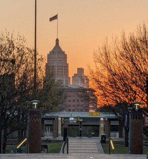
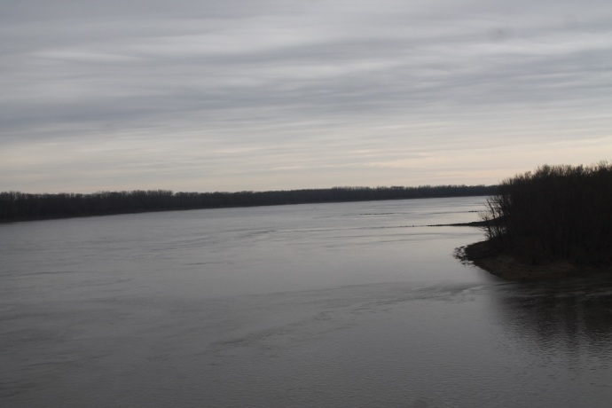
We crossed the Ohio River into Cincinnati at about 6 o’clock and we easily found Wiedemann’s Fine Beers, Brewery, and Pub on Vine Street in the north end of the city, just blocks off the Interstate. This is another Harvest Hosts host, and we’d booked in to stay the night in their parking lot. But it was Friday night, and the little lot, in the middle of the block, behind their building, was completely full. So we maneuvered our way back out and across the street to a mall, where they’d told us we could park until there was space in their lot.

It was raining (as it had been off and on all day), so we got into our raincoats and grabbed our umbrella for the run to the front door. The bar was packed, but we managed to get a table for two near the bar. It’s a fantastic place, with photos and paintings and beer posters and paraphernalia decorating the walls, ornate cornices around the ceiling, and fairy lights strung across from wall to wall. It’s warm and noisy, and although it’s big, with a games room and a number of rooms for dining, it feels cozy. A band was setting up on a stage in the next room. Exactly the sort of place you’d want for a local.

Sande ordered a pint of Kolsch and a beef dip sandwich with salad and I had a schnitzel sandwich with fries and their east coast IPA . We let the friendly but efficient waitress know that we were Harvest Host guests so that we wouldn’t get in trouble as a “no-show.” The food was good and the beer excellent, so tasty that Sande was talked into another half, while I needed no such encouragement to have another pint. We did some crowd-watching and listened to a few songs from the band while we finished our drinks, then paid up and went to check the parking lot.

There were still no suitable places to park up for the night, so we went across the street, moved Fred to a more sheltered place in the mall lot, and set up the bed and got things ready for the night. The restaurant closes at 11, but it was already thinning out a bit, so I thought we could check again in a little while, and if there still wasn’t a good spot, we could just park where we were for the night. We read until 9:30, then drove over into Wiedemann’s lot and found a great spot right against the back fence.

Once we were settled, we turned out the lights, put in our ear-plugs, and went to sleep. We didn’t hear a thing all night. This great night’s sleep at a fine brewpub on our final night provided a nice symmetry with our first night of the trip, when we stayed at Triton Brewing Co in Indianapolis, just 110 miles west of here.

I woke up at 5:30 to pee and, having had almost 8 hours sleep, couldn’t get back to sleep. When I got up to read, Sande suggested we head out so as to avoid morning traffic. We didn’t even bother with breakfast, just packed it all up and set out. We figured we’d stop at a Waffle House, a ritual we hadn’t yet indulged on this trip; I was pretty sure there was one not far up the highway, where we’d stopped on another trip, another morning when we got up too early.

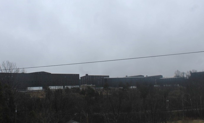
When we stopped to turn left onto Vine Street, a US Postal Services truck went by, but that was one of the very few other vehicles we encountered until we got onto the Interstate. We had to follow Vine Street a couple of miles up to Township Road before we could get across to a highway entrance. We passed through an industrial area (which is what you see from the I-75), but then entered an old working-class residential neighbourhood, called Elmwood Place.

There were old tall, narrow, brick houses with fancy cornices that are quintessentially Cincinnati, mixed with frame cottages, corner grocery stores, and little pubs. The empty, misty side streets were eerily attractive, but sadly, it was still too dark to take photos. I think we’ll have to explore the place more the next time we’re passing this way.

A few miles up the Interstate, we pulled off to find the Waffle House, which was right where I thought it should be. The place was bustling, and there was only one other white person there. We really enjoy the open kitchens in these places, with the wait staff calling out orders and bickering with the people working the grill. Sande got her usual pecan waffle and I ordered a bacon-and-egg sandwich on wheat toast. Apparently, the grill guy forgot about my order, but it was fun to watch them hurrying to get it done, glancing at me nervously and quietly blaming each other for messing up. The bill was less than $20, and we left smiling and ready for the road.

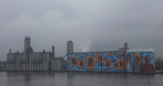
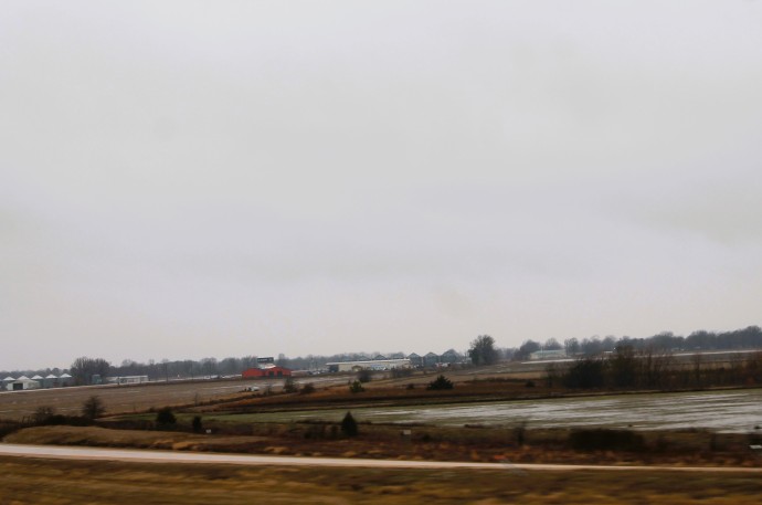
Then it was mile after mile through the flat, flat Ohio plain. Sande drove all the way, through Dayton and Lima and Findlay and Bowling Green and Toledo, stopping only once at a rest area. It was a dreary day again, and I worked on writing another blog post as we motored along, so there are few photographs.

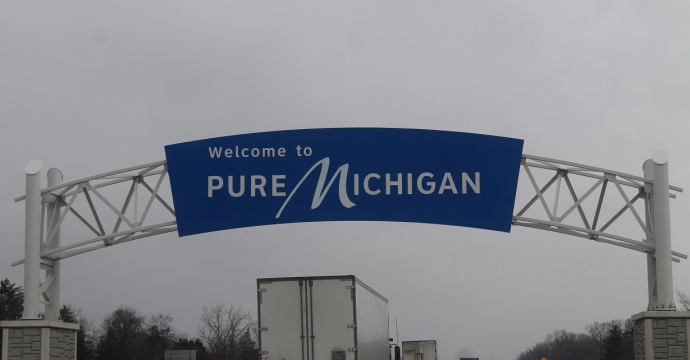
At Monroe, Michigan, we stopped to fill up the tank with that cheap American gas for the last time. I took over the wheel to drive through Detroit and across the river-border in the tunnel. Once again, the crossing was quick and painless, the border guard asking us only a few questions about how long we’d been away, how much we’d spent, and whether we had any alcohol or tobacco.

It was just after noon when I pulled over in Windsor to let Sande drive again. We thought about stopping at either the Sons of Kent Brewery in Chatham or the Brickhouse Brewpub in Woodstock for lunch, but decided instead to share the remains of Sande’s beef sandwich from the previous night and just kept driving. We were home shortly after three.

Categories: Contents: All Posts, Rick's Posts | Tags: , , , , , , , | 5 Comments

Back to Texas – Part 10

The Natchez Trace: Feb 28 & 29

From Arnaudville, we traveled north to Point Barre, where we turned east on US-190. To say we travelled north is not quite accurate because the route the GPS took us on seemed to go in every direction on the compass. I was sure we were going to find ourselves back at the brewery just around the next bend. But eventually we were heading east on 190. It was a cool and misty morning, with the odd shower of fine rain.

We crossed the Atchafalaya River at Krotz Springs and a little further on, at Livonia, cut north-ish again on a series of very minor roads that skirted False Lake, an old oxbow of the Mississippi. We soon crossed the Mississippi on the John James Audubon Bridge just after the town of New Roads. A few miles beyond the river, we picked up the famous US highway 61 (the “Blues Highway”), a fine divided roadway with little traffic.

When we crossed into the state of Mississippi, we stopped at the welcome center for maps of Mississippi and the Natchez Trace Parkway. I had a conversation with the charming old southern belle on the desk about the weather, and she told me that the previous summer had been the hottest in her life, over 100 Fahrenheit for days on end and so humid that the air conditioners couldn’t keep up, pretty much unbearable. According to her, we were visiting at the nicest time of the year. But it was still pretty cold and damp, in my view.

We got to Natchez (pronounced to rhyme with “matches”) around 11 AM and went directly to the Grand Village of the Natchez Indians. This National Historic Landmark is the site of the Natchez (pronounced nah-CHEE) tribe’s ceremonial village from 1682 to 1730, where the chief (the Great Sun), the priests, and other officials lived at the time of contact with Europeans. The Natchez culture emerged in this area around 700 AD and survived until the 1730s, when the people were dispersed in a war with the French colonists: those who didn’t escape to live with the Chickasaw were sold into slavery. There is a small museum at the site, where we watched a 20-minute film about the culture.

We then wandered around the grounds. There are three mounds, one the site of the chief’s residence and another the site of the temple, while the purpose of the third is unknown. Because the site was inhabited when Europeans arrived, there are detailed contemporary descriptions of it and some of the ceremonies held there, including the funeral for a chief. When a chief died, their house was destroyed and burned, and a house for the new chief was built on top of it. Thus were at least some of the mounds formed.

There’s really not too much to see, and the interpretive plaques are few and leave more questions than they answer. Still, it is worth a brief visit, even if only to pay respect to a people who lived and thrived here for a thousand years. There is an annual powwow held here in March and other cultural events throughout the year. The grounds and museum are open every day, and admission is free. When Sande spoke with the woman in the museum, she heard that they are about to begin a huge reconstruction project, recreating the village and structures.

After leaving the Village, we headed back to US-61 to fill up our gas tank. We considered going into town for some lunch, but decided we would head 15 miles up the Natchez Trace Parkway and make our own lunch at Mount Locust.


The Natchez Trace is an ancient trail from the lower Mississippi River to the foothills of the Appalachian Mountains, a trek of over 450 miles that crosses the traditional homelands of the Natchez, Chickasaw, and Choctaw nations. There is speculation that it was originally a series of animal corridors, and we know that it was used for hunting by Native peoples for thousands of years. Later, it was one of the main conduits for trade goods between the tribes of the Great Lakes Basin and those of the Mississippi Valley and from there on to the southwest and Mexico. As I mentioned in the last post, there are a number of pre-contact Native American sites, many with mounds, along the route.

When the United States was pushing its influence west in the late 1700s, Yankee traders (known as “Kaintucks”) were floating their goods down the Ohio and Mississippi Rivers on rafts to New Orleans, then traveling back north along the Trace. With Natchez one of the preeminent slave trading centres in the South, the trace became a major route for moving slaves between Mississippi and the northern slave states, Kentucky and Tennessee.

In 1800, president John Adams designated the Trace an official postal route, and in 1803, after the USA acquired Louisiana and the Mississippi Valley from France, Thomas Jefferson ordered the upgrading of the Trace from the terrible multi-stranded path it had been to the condition of a regular road that could handle fast post horses and wagons. During the war of 1812, the Trace was an important route for moving troops and supplies across the country.

In 1938, Congress established the Natchez Trace Parkway along the route of the Old Trace and made it a National Park. Over subsequent decades, a 444-mile-long two-lane highway was constructed more-or-less along the route of the Old Trace, across Mississippi, Alabama, and Tennessee. The park includes some 350 archeological sites and 22 Native ceremonial mounds, as well as numerous areas of natural and historical interest, three free campgrounds, and several visitor centers. Commercial vehicles are not allowed on the limited-access road, and the maximum speed is 50 MPH.

In 2019, we traveled the Natchez Trace Parkway in a southwesterly direction, from Nashville to Natchez, in our car. Even though the weather was cool and often drizzly, it was a magical way to travel for two days, far from the madness of freeways and cities. We stopped at many of the attractions and took detours to Muscle Shoals (home of a famous recording studio) and Florence (birthplace of Helen Keller) in Alabama and to Oxford MS (home of William Faulkner). We stayed overnight in Tupelo and visited the childhood home of Elvis Presley.

So when we needed a leisurely way to travel northeast this time—to avoid the frenzy of I-10 east and I-59, I-20, and I-65 north, which we’d experienced on our homeward journey in 2022—it’s not surprising that the Parkway came immediately to mind.


Mount Locust (at mile 15.5) was established in 1780 as a private home and plantation, but was soon turned into an inn (or “stand,” as they were called along the Trace) for the growing number of traders traveling up the trail. From about 1801 to 1944, the farm was home to generations of the same family. We had toured the restored house and grounds before and knew it would be a pleasant place to stop. When we got there, however, it was closed, but we just parked under oak trees outside the gate and enjoyed our lunch.

There are about 110 significant sites like this along the Parkway, with pull-offs and interpretive signs. Because we had been through here not long before, we decided we would stop only at places we hadn’t been before that sounded worth seeing (the map of the Trace has a brief description of each site) or places that we’d found to be especially interesting the last time. Mostly, we just drove along at a steady 50 to 55 MPH and enjoyed the scenery. Our destination for the day was the Jeff Busby campground, about half way between Jackson and Tupelo.

Just past Jackson (which you pass around without noticing it’s there), at mile 104.5, we stopped at the site of Brashear’s stand (a “house of entertainment in the wilderness”), where there are vestiges of the Old Trace. Most of the surviving segments of the Old Trace, like this one, are sunken (up to eight feet in places), worn down by the numerous feet and wagon-wheels and animal hooves that passed through.

Just up the road (106.9), we pulled into Boyd Site, where there were a few small mounds erected between 750 and 1250 AD. We realized that we had stopped here before, and there wasn’t much to learn from the plaque.

Fifteen miles further along, we stopped at the Cypress Swamp (mile 122), where we hiked the half-mile trail around the water-tupelo and bald-cypress water forest. There were a number of quite informative plaques along the path, and it was a pleasant break from the road’s pleasant drive. We didn’t bother stopping at French Camp (mile 180.7), the site of Louis Lafleur’s stand (1812), which evolved into a town that still thrives. We had stopped there the last time and had seen enough of the restored “historic village” that is part of the Park.

We reached the Jeff Busby campground (mile 193) sometime after 6 PM. The campgrounds along the Trace are free on a first-come-first-served basis. Most of the sites were taken, but we found a nice level one not too far from the restrooms. I made us a sausage and potato stir-fry with onion, garlic, and red pepper, while Sande relaxed with a beer (she had been driving all day, a total of 325 miles, and had a sore neck and back).

After we’d eaten and washed the dishes, we got out our coats to head to the restrooms to brush our teeth. It had been getting colder all day, and we were looking forward to near freezing temperatures overnight. This was the moment we realized that our southern winter vacation was really coming to an end. This was one of the quietest and darkest sites we’d had on the whole trip, and we slept like logs.

We were up relatively early on Leap Year day, and Sande made bacon and eggs and beans and toast for breakfast. After we’d cleaned up and put everything away, we drove up the campground road to the lookout on the top of Little Mountain, the highest point in Mississippi. On the way up, we startled two herds of white-tailed deer, and they darted across the road ahead of us and scattered down the mountainside. It was 4 degrees Celsius when we were taking photographs from the lookout.

We were back on the Parkway by 8:30. I was driving today, so Sande was able to study the map for places she wanted to visit. She was surprised to see that the map showed the route of the Old Trace as well as that of the Parkway, and to find that the two paths criss-crossed frequently and were, at times, quite far apart for long distances. She became obsessed with spotting and photographing the Old Trace.

When we were bypassing Tupelo, I decided I’d like a cup of good coffee, so Sande used the GPS to locate a coffee shop and navigated our way there. Lost & Found Coffee was in a pretty nondescript strip mall off the main drag behind a shopping mall, but it was cheery and crowded. The staff were helpful and friendly, and the Americanos were great.

We had back-tracked a ways by coming back south through the city, so when we got back on the parkway, we were covering road we’d been on just minutes before. We decided to check out the Chickasaw Village site that we’d passed by earlier, but when we got there, we realized we’d spent quite a bit of time there in 2019, so we just got back on the road.

We pulled in to the Pharr Mounds at mile 287, but again we realized we’d been there before. Our next stop was at mile 327, in Alabama now, at the Colbert Ferry site. Here, on the banks of the Tennessee River, Chickasaw chief George Colbert had a stand and ran a ferry across the river in the early 1800s. The information boards were really quite good, and there were older plaques and monuments on the site.

We had thought about going over to Florence and Muscle Shoals to find some lunch, but I’d discovered that the wonderful little restaurant where I’d had fabulous shrimp and grits in 2019 was now permanently closed. Besides, there were some interesting things to see along this stretch of Parkway that we’d missed on that trip because of our detour to Muscle Shoals. So we just kept cruising along. We crossed into Tennessee around mile 340. In this stretch, the Old Trace crossed the Parkway many times, and we stopped at several locations so Sande could take photos.

Around mile 376, we cut off the Parkway to drive along a section of the Old Trace. This 2.5-mile one-way road is narrow and twisty and extremely hilly. It climbs quite high before descending steeply to a stream running along a ravine just before rejoining the Parkway. You get a real sense of how rugged and difficult the Old Trace was, and you understand immediately why RVs and trailers are prohibited. This little detour was a definite highlight of this traverse of the Trace.

We drove on by the site of the stand where explorer Meriwether Lewis died in mysterious circumstances in 1809 (mile 386) because, again, we’d spent quite a bit of time there on the previous trip. Instead, Sande looked up the story of his death and the controversy around it and read it to me as we drove along. For the same reason, we passed the Gordon House (mile 408), the site of a trading post and a ferry across the Duck River run by John Gordon in the early 1800s.

Initially, we thought we’d follow the Trace to its northern terminus at mile 444, but we remembered that, on our last trip, we missed visiting a town that was described as having the “most picturesque main street in the nation,” and we thought it was Franklin, which we could best get to by cutting off the Parkway at Leiper’s Fork around mile 428. So we decided to do that.

As we drove through Leiper’s Fork, we saw that it was a very interesting old place, but we were intent on getting to Franklin. When we drew near Franklin, things started to look familiar, and as we walked down the main street, we didn’t think it was picturesque at all. It was just lined with chi chi shops that mostly obscured the historic buildings. The only saving grace was an old cinema.

We quickly got back into the van and went in search of gasoline; after filling the tank, we had to drive back through the town center to get to the Interstate, and we realized that this was just a posh bedroom community for Nashville. It dawned on us that it was really Leiper’s Fork that we had wanted to visit, that we’d just repeated the same mistake we’d made on our last trip. But it was too late to go back there. We thought that, since we were so close, we’d go into Nashville, check out Music City Row, and maybe have some dinner.

After two days on the serene Parkway, Interstate-65 was sheer madness, but we found our way onto Broadway and found ourselves in even greater madness. Looking for parking, we turned up 5th Ave by Tootsie’s Orchid Lounge and drove past Ryman Auditorium (original home of the Grand Ole Opry). The first parking lot we pulled into wanted $10 for each half hour, so we drove further out 5th and found street parking on Union St, for which we paid a few dollars for two hours.

We wandered back to Broadway, which was packed with people in cowboy hats and jeans and young women in very short skirts and skimpy tops despite the cold. Everybody looked like a hayseed or a wannabe country star. Lots of sequins and bolo ties. Every bar had its windows or doors open to the street and had very loud, drum-heavy bands blasting out music neither of us recognized or enjoyed. We walked several blocks without finding anywhere that attracted us, so we turned around, went back to the van, and headed out of town.

Looking back now, I’m sorry we hadn’t walked north from our van and visited the Tennessee State Capitol up on the next block instead of braving that frenzy. But we did get a few good photos.

We went west on I-40 out of Nashville, our destination being Montgomery Bell State Park, where we’d stayed three times before. I’d booked our regular site a few days earlier. However, because we hadn’t found dinner in Nashville, we decided to go to the Catfish Kitchen a few miles beyond the park and to eat there before settling in for the night. It was already getting dark when we exited from the Interstate, but we’d traversed these narrow windy roads before and knew where we were going.

The catfish (fried with French fries for me, broiled with lemon and baked potato for Sande), the coleslaw, the hush puppies, and the spicy lima beans were all good, as always, and I drank too much sweet tea. We got back in the van, went back a mile or so, and found our site by the stream at Montgomery Bell. We were soon hooked up to the power and the water.

It was too early to sleep, so I worked at the table on the blog about our stay at Pedernales State Park while Sande made herself some tea and wrote in her diary and read in the front of the van. Despite the weak cell reception, I finally managed to get the blog posted just before 11 PM, a very late night for this trip. We hurriedly made up the bed so we could get some sleep. It would go below freezing, so we put on an extra blanket.

Categories: Contents: All Posts, Rick's Posts | Tags: , , , , , | 2 Comments

Back to Texas – Part 9

The Road to Bayou Teche: Feb 27

It had been our plan to head north from Brazos Bend, up through the Piney Woods of east Texas to Mission Tejas State Park and the nearby Caddo Mounds State Historic Site near Nacogdoches, then on up to Atlanta State Park just south of Texarkana. We’d then head back through Little Rock and Memphis to Nashville, where we’d turn north for home. But the forecast was for a cold front to come down from western Canada, which would cause the temperatures to drop 20 degrees and produce violent storms, with the possibility of tornados, right along our route exactly when we were going to be there.

So we decided we better stay south until the worst of it was past. It was for this reason that we headed for Galveston when we left Brazos Bend. Sande was sorry that we’d miss the Caddo Mounds, but I suggested we could go from Lafayette, LA, up to Natchez, MS, where there is a mound site, then up the Natchez Trace Parkway, along which there are numerous mounds. She was happy with that plan.

We therefore headed east from Brazos Bend on Farm to Market Road 1462 through more ranch country. When we’d gone about 15 miles, I spotted a post office and swerved off the road into the parking lot. I had a pocket full of change and a 50-dollar bill with which to buy the one stamp for Kieran’s birthday postcard; luckily I didn’t have to break the 50, as the stamp was $1.53, and I had exactly $1.55 in change.

At Alvin, we picked up highway 6 for a ways, then cut east to I-45, which runs from Houston down to Galveston. There were oil refineries further to the east, and as we drove south toward the coast, there were more and more resorts and RV parks and condo developments. As we neared Galveston Bay, the fog rolled in, but it wasn’t as thick as it had been when we came through here heading north in 2012. Soon we were across the Causeway and into the city of Galveston.

We had spent a couple of days here in 2012, camping at Galveston State Park and exploring the Strand (commercial) and East End (residential) Historic Districts. Driving through on Broadway Avenue brought back lots of memories, but we didn’t stop. We wanted to have lunch on Crystal Beach on the Bolivar Peninsula, so we went right on through to the ferry dock. It was a short wait and we got on the first boat (unlike two years ago); within a half hour we were driving along the Peninsula.

We pulled in to the Big Store to buy some beer and a few groceries, then drove a bit further along to a public beach access road. We parked on the beach with our back window facing the Gulf and had a lunch of tuna salad that Sande had made before we left Brazos Bend that morning. This was pretty much exactly the spot where we’d boondocked one night in 2022. After lunch, Sande took her sandals off and walked into the water a bit, just so she could say she’d done it. I was a bit worried that we’d get busted for not having purchased the requisite $10 annual beach parking pass, but there was almost nobody around, and only two vehicles drove by along the sand.

As Sande drove east then north towards Winnie and the I-10, I got on the Harvest Hosts app and booked a night’s stay at the Bayou Teche Brewery in Arnaudville, north of Lafayette, LA. This was the same route we’d traveled in 2022, and I-10 was as busy as ever. At Beaumont, we found our way to Spec’s Wines, Spirits & Finer Foods, quite a long way up US-96. They didn’t have the prickly pear liqueur that Sande wanted to buy for a neighbour, so she bought a bottle of bourbon-barrel cabernet instead.

I took over the wheel and soon entered a very long stretch of construction that made the driving even more of a hair-raising white-knuckle nightmare. At one point the lane I was driving in turned into an exit, and I ended up on a sideroad heading south. After a U-turn I discovered the on-ramp to the Interstate was under construction and closed, so (with Sande directing)I did another U-turn to get back to a service road that ran for about 20 miles before I could get back onto the highway.

We crossed the state line just past Orange and were soon motoring through Lake Charles. As I drove, Sande looked for a good Cajun restaurant in Lafayette, reading the reviews and menus aloud for me. When we finally got to Lafayette, it was still too early for dinner, so we decided to head into town and try to find the historical district. Our GPS didn’t seem to know where we wanted to go, so we overshot the mark and ended up in a pretty interesting working-class residential and commercial area on the south side. But eventually we made our way back along Congress to Jefferson, and drove slowly through an obviously bustling city core.

We followed Jefferson east to the Evangeline Thruway and turned north. Five or six miles beyond the I-10, we pulled in to the parking lot at Prejean’s Cajun Restaurant in Carencro. Prejean’s is a big barn of a place, with a stage at one end for the live music and tables covered with red and white checked tablecloths scattered around the floor. A nice bar (called the Cypress Tavern) along one wall and interesting decorations (including a 10-foot stuffed alligator on a log) make it seem almost cozy.

The menu has oysters and crawfish and gator. There are Zydeco Stuffed Shrimp, Crawfish Bon Temps Rolls, Fried Green Tomatoes, Catfish Grand Chenier, Crawfish Etouffee, and Seafood Gumbo. We shared a fried eggplant with crab béchamel sauce appetizer, I ordered a local IPA and an oyster po’boy (the first I’d had in at least 5 years), and Sande got a limoncello frozen martini and a pork chop with rice-and-beans and a side of very spicy green beans. It was all delicious, and we were so stuffed we could barely walk out of the place.

It was starting to get dark when we headed north on I-49. Ten miles up the road, at Grand Coteau, we turned east on state road 93. This narrow road winds through the Cajun countryside some eight miles to Arnaudville. When we got to the intersection in town, we turned right on highway 31, as directed by the GPS. As soon as we saw the Fire House Bar and Cafe, we realized this was the wrong road, the same one we’d taken the last time we were here, so we turned around. This time, we crossed Bayou Fusilier, then turned right across Bayou Teche on Fuselier St and right again onto highway 347, the Bushville Highway.

The Bayou Teche Brewery is about half a kilometer down. When we pulled into the brightly lit parking lot, we saw that there were a travel trailer, a truck camper, and a big motorhome already parked up. We pulled into a spot that was not too close to any of the other campers or to any of the dazzling lights. I went in to introduce myself to the young woman at the pizza counter inside, and she told me we were fine where we’d parked.

After setting up, we both went into the bar and ordered a couple of beers, an IPA for me and a Kolsch for Sande. We went out to a picnic table under the lights strung across the outdoor patio to enjoy our drinks and try to remember our visit here two years earlier. When I went in to pay, I bought 6 bottles of LA 31 Acadie French Farmhouse Ale to take home (alas, they don’t bottle the Kolsch, which Sande liked a lot).

It was about 7:30 PM when we got back out to the van. It had been a long day and a long drive, so we got right into our pajamas and into bed. We read for a bit, but soon turned out the lights. It wasn’t long until everybody cleared out of the brewery and the campers settled down, but the bright parking lot lights and the flashing sign by the road stayed on. It was quite warm, so I left my window open a crack, and we were probably asleep by shortly after 8.

Sande woke up at 4 and couldn’t get back to sleep because of the lights and the noise of the brewery’s compressors, which ran intermittently. Then, shortly after 5, traffic started up on the highway, probably commuters going to Lafayette or Baton Rouge, car tires whining as they picked up speed coming out of Arnaudville. That woke me up, but I managed to get back to sleep for awhile. Sande made coffee around 6, and we ate cereal for breakfast. After doing the dishes and packing up, we both used a spotless porta-potty over by the patio before hitting the road.

We headed north on 347, bound for the Mississippi River and Natchez.

Categories: Contents: All Posts, Rick's Posts | Tags: , , , , , , | 2 Comments

Back to Texas – Part 8

Brazos Bend State Park: Feb 25 to 27

When I left you in the last post, we were heading out of San Antonio eastbound on I-10, with Sande driving. It was a sunny Sunday morning (almost three weeks ago now), and we had country tunes blasting on the stereo. After about 30 miles, we cut off on Alt US-90 through the town of Seguin, which has a rather-bigger-than-life-size sculpture of a pecan in front of the old County Courthouse. We passed through here on our last trip to Texas two years before, but I still took a photo of the “world’s largest pecan.”

At Gonzales, 30 miles further east on Alt US-90, we pulled in to the Walmart to pick up some groceries and a few other things. We realized that the store just didn’t have some of the things we wanted and others were in quantities that were too big for our fridge, so we ended up getting only a belt for me, a sundress for Kinsley, a small pecan pie, and a battery for our digital thermometer. Well, it was actually three batteries, probably enough to last us for the rest of our camping lives.

We kept motoring east through Shiner, which has a large brewery that supplies good beer to all of Texas and beyond. We’d been through here in 2019, so we didn’t bother stopping. Just before Hallettsville, we slowed down when we saw a large painting of Jesus in front of some slightly shabby wooden buildings. A hand-painted sign said “Drive Time is a Great Time for a Little Prayer ” and another “Pecan Grove Apparition Park.” Sande swerved into the gravel parking lot.

We discovered that this was an old roller skating rink, constructed in 1945, and that the Virgin Mary had appeared here at some point in the last 80 years. There was a shrine to the Mother of God, with dozens of photos and testimonials, bouquets of artificial and real flowers, and some burning candles. We also found the stations of the cross, crudely depicted, along the entrance to the outdoor roller rink, which was intact but no longer in use. A sign in the shrine said that the anniversary of the apparition was celebrated at this site the second Sunday of every September at 3 PM. If we’re ever in the area on that date, we’ll be sure to check it out.

In Hallettsville, we walked around the town square and took photos; the Lavaca County Courthouse is one of the most impressive we’d seen in weeks. We then headed to the city park, where we made sandwiches for lunch, after which we went to the Brookshire’s grocery store on the north edge of town to pick up what we’d need for the next couple of days. Then it was back down to Alt US-90 and onwards to the east. Just beyond East Bernard, Sande turned southeast on Farm to Market Road 1875, a rather narrow roadway with bad pavement and no shoulders. At Needville, about 15 miles on, we joined state highway 36, and the road got better. Another 10 miles and we turned left onto the road to Brazos Bend State Park.

This park is still within the prairie that we’d been driving through all day, all open ranchland with scattered oak trees. But it encompasses three or four small lakes and a large cypress swamp lying just west of the Brazos River. It is only about 40 miles from the Gulf of Mexico, so the climate is almost tropical. The park is known for its birds, alligators, and snakes such as cottonmouths, copperheads, and corals, among others. There are two campgrounds and a number of hiking trails. We’d booked a site for two nights.

We checked in, found our site, and connected up the water and power. By 4:30, we were enjoying beers in our camp chairs beside the van. The temperature was still in the high 20s and would go down to only 15 overnight. We made a dinner of penne with tomato sauce, barbequed Texas smoked sausage, and salad. After eating, we had a video call with Amy and Kinsley (who would be leaving for a week in Cuba the next day), then played some Scrabble and read before turning in.

On Monday morning, after breakfast, we unhooked the van and drove to 40 Acre Lake trailhead parking lot. We packed our binoculars and the 300mm zoom lens for our camera into our backpack along with the water bottles and granola bars, since we were hoping to see some wildlife along the trail.

The path circles the lake, with the lake on one side and swamp on the other. It was still misty over the lake and the swamp. On the first leg of the trail, we saw only egrets, some sort of duck, and large black birds that looked sort of like the anhingas we knew in Florida—they perched in the trees with their wings spread out to dry. At a junction, we climbed the observation tower, which gave us a panoramic view over the park, acres of swamp and water with ranchland off in the distance.

We decided not to take the trail through the swamp to Elm Lake, but rather to continue on around 40 Acre Lake. We met a young couple, who asked whether we’d seen any alligators; they hadn’t either. But we’d hardly walked 100 meters when I spotted a young gator, maybe 4 feet long, lying on a log. Within a similar distance, I saw two more, both about the same size. And then, when I stopped to take a photo of an egret off among the cypresses, I noticed an orange and brown and black snake coiled not far from my foot, just off the path. There were still lots of birds on the lake side of the trail.

When the Lake trail ended, we crossed the Park Road and started on the Prairie Trail. This wasn’t nearly as interesting, since for the most part it traversed open fields. We saw animal trails through the grass, deer and coyote tracks in muddy patches, and some scat on the path, as well as some pretty big ant hills beside the path. Other than a few birds off in the distance and some horses at the edge of the prairie, the most interesting thing we saw was Fred way across the field in the parking lot. We figured we’d walked about 2.5 miles in total, not a lot, but good enough.

When we got back to Fred, we drove over to the Park Store. Sande looked at the souvenirs on offer while I showed my photos of the snake to a couple of park rangers. They said it was a broad banded water snake, which is not venomous but still might bite if startled. We bought a Lego alligator for Kinsley and a post card to send to Kieran for his birthday (sadly, they didn’t sell stamps and we’d forgotten to bring the ones we had from our last trip, so we couldn’t mail it from the park).

Back at our site, we headed over to the comfort station, where we both had showers. It was now 26 degrees and humid, really quite pleasant. Sande took a wrong turn coming back from the shower, and ended up taking a walk all around our campground. When she got back to the van, I was having a nap, so she read her John Prine biography until I woke up. After lunch (pastrami and Swiss sandwich for me and an apple, tortilla chips, and hummus for Sande), we seem to have just lazed around the camp site, Sande writing in her diary, both of us probably reading.

We made rice and chicken curry for supper. I made the mistake of adding yoghurt to the curry while it was cooking, and it curdled, but it was still quite delicious. We had the pecan pie with vanilla ice cream for dessert, which was even better. Being able to keep ice cream in the freezer is definitely one of the great advantages of camping in Fred. Again, we played some Scrabble and read in bed before turning out the lights, definitely something that is becoming a bit of a ritual.

In the morning, after a cool, quiet, and very dark night’s sleep, we had our usual breakfast and packed everything up. I filled our fresh water tank to about two-thirds, since we would not have any hook-ups for the next 2 or 3 nights. Before leaving the park, we dumped our waste tanks. We were on the road by about 9, headed east and south, towards Galveston.

Categories: Contents: All Posts, Rick's Posts | Tags: , , , , , | 2 Comments

Back to Texas – Part 7

San Antonio: Feb 24-25

It is about 65 miles from Johnson City to San Antonio, straight down US-281. We stopped on the square in Blanco, then again for gas just south of that town. Not long after that, we passed Bulverde and the road to Guadalupe River State Park, where we camped for a few days two years ago (see “Guadalupe River State Park,” if you’re interested).

It was Saturday, and there was no hope of getting a site at a state park anywhere close to a big city. There were no Harvest Hosts around San Antonio either, but iOverlander.com lists some “informal” camping spots in the city. The most attractive was street parking right next to a River Walk access point that cost only $3.00 for the day and was free overnight. Our friends, the crew of Slow Sally, had camped there successfully just a month earlier (see “Vanlife Adventure in San Antonio“). So that’s where we were headed.

Our GPS got a little confused in the tight tangle of streets under the elevated I-10/I-35 interchange, but we managed to go around a block, find the right street, and grab a parking space immediately across from a little park and the steps down to the Walk.

The San Antonio River, which winds through the center of the city, is, like many rivers in Texas, naturally prone to flooding. After heavy rains upriver put downtown streets under nine feet of water, killing 51 people, in September 1921, the city and state decided to do something. A dam was built upriver and a channel constructed to bypass the river’s loop through the downtown core.

In 1929, an architect named Robert Hugman proposed that the river through the city be turned into a park, a level down from the streets, with walkways on each side. He suggested that this extended parkway should become the focus of commercial development in the city core. This plan was adopted in the late 1930s, with Hugman named project architect, and work started in 1939.

The initial stage was completed by 1941, and the system, now known as River Walk, was extended over the next several decades, with a canal extended out to the east from the original loop. Hotels and other properties along the route opened restaurants and shops at river level, and stairs up to street level were constructed to provide access to museums and other attractions. A new convention center, a shopping mall, and numerous hotels and other attractions were constructed to take advantage of River Walk.

On our 2012 trip, we visited San Antonio for just long enough to have lunch at a restaurant on River Walk and to determine that we didn’t care enough about the Alamo to put up with the crowds and the long line-up. This time, we thought we’d invest a bit more time in the place. So as soon as we’d got the van parked, we descended the steps to the river and headed towards the main loop, where most of the action is. It was lovely to get away from the bustle and heat of the streets and stroll beside the river.

I’d identified a couple of restaurants that weren’t too far away as possibilities for lunch. At the first one, all of the tables on the patio overlooking the river were occupied, so we moseyed along to the next one, Domingo, where we were able to get a table for two on the river-level terrace. We ordered guacamole and chips for an appetizer, Sande had a Quinoa Chili Bowl and a Clean Wave (non-alcoholic) cocktail with a passion flower blossom in it, and I had Short Rib Quesadillas and a local IPA. It was a very pleasant lunch, with lots of interesting people to watch.

We then continued our walk around the main loop through downtown San Antonio. We went up to street level to check out the sculpture garden at the Briscoe Western Art Museum and the San Fernando Cathedral on the Main Plaza, the heart of old, historical San Antonio. Otherwise, we just moseyed along, enjoying the ambiance and taking photos. Tour boats ply the river in both directions, their guides describing people and buildings, but they were remarkably quiet and not at all disruptive to the laid-back vibe.

When we got back to Convent Street, we rose to the surface again and relaxed in the van for awhile. At some point, Sande realized there was a shadier and more level parking space overlooking the river-side park, right on the bridge over the river, so we moved the van across the road.

A few hours later, as the sun was going down, we noticed that we were getting hungry again. We Googled restaurants nearby, and the one we found most interesting was the place we’d rejected at lunch time, Acenar Mexican. We walked there at street level, along the way walking by some of the buildings we’d earlier admired from down below. We were able to get a good table on the patio. I ordered Oyster Tacos and a beer; Sande had the Ensalada de la Casa and sangria.

It was dark when we finished, and we walked back to the van along the river. Some of the trees were filled with birds, filling the air with their chatter. There were fairy lights hanging from some of the trees, as well as other interesting lighting effects along the way, and we passed a number of other couples walking hand-in-hand in and out of the shadows. All very romantic.

Bonds Rock Bar was just up at the corner of the street on which we were parked, and we were worried that it might get raucous when the band started playing and the patrons got drinking. All we heard were a bunch of Harleys arriving and parking across the street around 9:30 and leaving a half hour later, then a gaggle of people making a lot of noise while waiting for a taxi when the bar closed at 2 AM. Otherwise, it was quiet and we slept soundly.

Until 6:30, when a loud SUV pulled in just in front of us and sat with its engine rumbling, then another vehicle came by and blasted what sounded like an air horn, and we heard some men in loud conversation. I didn’t like the vibe, so we quickly got dressed. When we opened the curtains on the windshield, we saw that it was just a bunch of workers coming on shift, perhaps to clean the streets. But by then we were up and ready to go, so we went.

We hoped to find some coffee and maybe pastries around the Historic Market Square, but the whole area was a mess with road works and nothing seemed to be open, so we headed down to South Town. There, we found the Blush Bakery, where we got cappuccinos, a chocolate croissant, and a cinnamon bun, which we enjoyed on their lovely patio while the restaurant staff got ready to open for brunch.

After breakfast, we walked around a bit, admiring the blocks of lovely little cottages south of Alamo St, then got in the van and drove over to the King William Historic District. There we were blown away by the extravagant mansions of the early city’s wealthy citizens (many with plaques out front outlining their histories), as well as the (literally) towering buildings of the Pioneer Milling Company just across the river.

When we’d had enough of all that elegance, we got in the van and headed east across the city and onto I-10 eastbound. Our next stop would be Brazos Bend State Park, southwest of Houston, where we had a campsite booked for two nights.

Categories: Contents: All Posts, Rick's Posts | Tags: , , , , | 1 Comment

Back to Texas – Part 6

Pedernales Falls State Park: Feb 21-23

On Wednesday morning, we had scrambled eggs for breakfast, then packed everything up and headed over to the dump station to empty our waste water tanks. We had to go back to our site because I’d left my cleaning rag hanging on the lantern hook. Then we drove into Burnet to do our laundry. On the way, we saw several flocks of turkey vulture devouring the previous night’s road kill.

At the Texas Wash House (a spotless place with dozens of machines), we loaded up two washers and fed them with quarters we had left over from our trip to Florida last winter. Sande wrote in her travel diary and kept her eye on the laundry while I went out to the van, checked that the injectors weren’t leaking one last time, then vacuumed or shook out all the rugs, swept the galley floor, and straightened everything up.

When the laundry was done, we drove over to the H.E.B. to get some groceries for the next few days, then parked on the historic town square to poke around and take photos. For the first time, the county court house was not a neo-renaissance pile with a soaring clock tower, but rather a somewhat menacing mid-century-modern brutalist bunker of a place. The buildings around the square were, of course, the usual late-nineteenth and early-twentieth-century mix of false-fronted western-style single-story shops with awnings out front and multi-story Victorian buildings with ornate brickwork.

Most of the shops were occupied and seemed to be thriving, and some had plaques relating their histories. There was a newspaper that had been operating out of several of the buildings for over a hundred years, a number of antique shops, and several boutiques of various types.  In front of the historic town jail there was a statue of the longest-serving sheriff in Texas, who retired in 1978 after serving 39 years.

We poked our noses into the Unshakeable Grounds Café, but didn’t much like the evangelical Christian vibe and didn’t see anything on the menu that appealed. So we drove the 15 miles south to Marble Falls, where we first stopped at Walmart to pick up a few things—two LED puck lights to brighten the galley and cupboards and some clips to hold our sheets on our mattresses.  We then went to a park beside the lake in the middle of town (apparently the falls of the city’s name were submerged when this lake was created on the Colorado River), where we made ourselves lunch and ate it in the van.

It was about 23 miles down US-281 to Johnson City (Lyndon B. Johnson grew up around here, and his famous ranch is just a few miles down US-290). We turned east on Farm Road 2766 and drove about 10 miles to the road into Pedernales Falls State Park (pronounced Perd-uh-NAW-lus, and Spanish for the flint found everywhere). The Pedernales River winds through the extensive park in a deep-carved ravine, and there are miles of trails for hiking, biking, and horse-back riding.

It is not far west of Austin, so its 60-some campsites are always booked up on the weekends, and it has to limit the number of day visitors. When we were there, however, only about a third of the sites were occupied, and we ran into few people on the trails.

As soon as we found our site, we drove to the trail leading to the actual falls, at the north boundary of the park. We walked down to a falls overlook, then I waited there while Sande descended the long flight of stone steps down to the river and explored the rocks around the falls. The ravine is subject to flash floods (as signs warn everywhere), but when we were there, there was only a small stream of water.

Back at the campsite, we got out our chairs and some beers, a Hop Sprocket IPA for me and a Cruzer Kolsch for Sande, both from Real Ale Brewery in Blanco, south of Johnson City. There was no cell reception at our site, so after dinner (salmon, cranberry, and gorgonzola burgers with carrot sticks and hummus) we went out to the gatehouse for a video call with Amy and Kinsley.

When Kinsley saw Essell and Arjee looking out the back window of the van, she asked what they were looking at, and, when we showed her the vista across the valley, she said “That’s so lovely!”

Back at the site, we made up our bed with clean sheets and pillow cases, got into our clean pajamas, and crawled into bed. It was the first night of the trip with only one quilt on our bed, and we were able to leave our windows open to let in a breeze.

On Thursday, it was overcast when we woke up and not as warm as the previous day. After breakfast, I worked on a blog post for a few hours while Sande found the comfort station and explored the campground, then read until I was done. By then the sky had cleared and it was warming up, so we got stuff together to go on a hike.

We walked along the campground road to the Twin Falls Nature Trail, which descends into the ravine. We knew that the last part of the trail, down to the river, was closed for restoration, but there was supposed to be an overlook above the falls. We heard the falls below us, but never found the overlook and couldn’t see the river from the path. When the camera battery died, we decided to head back the way we’d come.

Sande wanted to go down another trail to a ford called the Trammell Crossing, but I realized that if I descended into the valley again, I might not be able to make it back up, so we put that off. We went back to the van and made a lunch of Queso Menonita (Mexican Mennonite cheese) on sourdough bread, both of which we’d picked up at H.E.B. the day before. The cheese was a bit bland on its own, but with some of Sherri’s cardamom plum jam, it was great!

After lunch, we went back out to the gatehouse so that I could upload the post I’d been working on and Sande could converse with Vanessa in Victoria. Sande sat in a chair in the shade of a tree, looking out over the river valley, enjoying a nice breeze and the 29-degree temperature. There was a steady stream of people coming into the park, both day-trippers and campers.

Back at the campsite, I worked on another blog, while Sande did the lunch dishes, then sat outside and read. When I finished, we had beers in the sun before making a stir-fry supper of onions, garlic, red pepper, celery, carrots, new potatoes, and the rest of the smoked sausage with thyme and white wine. We cooked and ate outside so we wouldn’t heat up the van. We ended up having to put the AC on anyway while we washed the dishes.

After supper, I finished the blog post and Sande proofread it. It was cooler than the previous night, so we put both quilts on the bed.

Both of us were awake and read for awhile during the night, so we slept in until 7:30 on Friday. We had bacon and eggs and baked beans for breakfast (toast for me, corn tortillas for Sande). We then walked down the fairly gently sloped trail to the Trammell Crossing, where we took off our shoes and socks to cross the ankle-deep river on what was an old asphalt roadbed.

The climb up the other side was a bit steeper, but it was a good, wide road, so it wasn’t too difficult. Up on the plateau, we walked the Cypress Mill Trail. It wasn’t particularly interesting scenery, just a lot of prickly pear cacti, scrubby bushes of various sorts, and small trees. The entire trail was much too long for us, so we just took a shorter spur and looped back down to the Crossing.

We started on a smaller trail alongside the river, hoping we might get to the Swimming Hole, but realized that would be too far as well. So we took another trail back to the one we’d come down, and went back to our campsite. The entire circuit was about 4 miles, not bad for someone recovering from pneumonia.

After lunch we went out to the gate to upload my latest post. Back at the campsite, Sande wrote her post about visiting the Longhorn Cavern and chose the photos to go with it. We had bacon-wrapped beef tenderloin with rice and salad for supper.

In the morning, we both had showers before packing everything up for our departure from Pedernales Falls. We stopped again at the gatehouse to upload Sande’s post. Then we headed back out to Johnson City and south again on US-281 toward San Antonio.

Categories: Contents: All Posts, Rick's Posts | Tags: , , , | 5 Comments

Back to Texas – Part 4

Glen Rose (expect the unexpected): Feb 17

As I mentioned at the end of the last post, we were headed for Dinosaur Valley on Saturday morning. We zig-zagged in a generally northwesterly direction on a variety of little-used secondary roads through Hill Country ranchland. Up to Lakeside Village, west to Morgan (where we crashed across a not-at-all-level 2-track crossing), on a windy little road to Walnut Springs, then north to Glen Rose on highway 144.

We crossed a river on an old bridge by an old mill and directly into the lovely downtown of Glen Rose. This is obviously a town that is doing well, with the historic buildings repurposed into cafés, antique shops, B’n’Bs, and a book store. There’s an old hotel still operating.

But it was 10:30 and we wanted to get to Dinosaur Valley State Park, so we didn’t stop; we could always come back after visiting the park. We had to wait for a long red light on a steep incline in the left-turn lane at US-281. When the light turned green and I pulled into the intersection, the engine sputtered and the Check Engine Light (CEL) came on. I drove about a quarter mile, the engine missing badly, until I could pull off into a parking lot.

I got out my OBD code reader and discovered two error codes: P0208 for a faulty fuel injector on cylinder 8, and P0308 for a misfire on cylinder 8. Clearly, the bad injector was causing the misfire, but research showed that the fault could be the injector itself, the wiring to the injector, or the Engine Control Module.

Google found one garage open until noon on the east end of town, so we headed back that way. The engine was running very poorly, and if I tried to accelerate too quickly, the CEL flashed (indicating that we might be causing damage to the engine or the catalytic convertor). When we got to the garage, we discovered that the mechanic had taken the day off for a funeral and that they were booked solid on Monday.

We drove around the corner to an O’Reilly’s Auto Parts where we could consider our options. I had never worked on a fuel injection system, so I was hesitant to try to diagnose the problem and repair it myself. We called a Dodge dealer in Granbury, about 17 miles away, and though they were open, they were booked up until the following Thursday.

I then discovered that there were four mobile mechanics in the area. The first guy answered his phone, but said he was on the way to Fort Worth to pick up a lawn mower and wouldn’t be back until 6 PM. He wanted $260 cash down for up to two hours work, plus $1.50 per mile. I told him I might call him back. I left messages for the other three guys, and did some more Googling about the problem while we waited for a call-back.

I was trying to get ahold of the first guy to arrange for him to come, when I got a call from the last guy I’d called. He (Blake) said he was free to come over and take a look, but first he wanted to call O’Reilly’s to see if they had an injector for our vehicle in stock. His rate was $110 per hour worked. We told him to go ahead with it.

He called back a few minutes later and said O’Reilly’s had to order the part, and it wouldn’t be there until 5 PM. The problem was that he quits work at 5; he wondered if he might come over first thing on Sunday morning to do the work. He didn’t normally work on Sundays, but he’d do it for us. It seemed our best (maybe only) option, so we agreed.

I went into O’Reilly’s, explained the situation, and asked the assistant manager if it would be alright for us to camp over night in their lot. He agreed that we could, as long as we didn’t park in the spots reserved for staff. I called Artesian Ranch to tell them we wouldn’t be able to make it for our night’s stay with them.

It was just after noon, and we were out on the east fringes of town. There was a café next door, a burger joint up the road one way, and a barbeque place in the other direction, but nothing else around. There were no sidewalks along the busy highway, and it was at least a mile to the downtown. We didn’t want to drive the van in case it would really cause expensive damage. So, we were stuck in a parts store parking lot for a long, hot afternoon and evening.

Sande read and napped and wrote in her travel diary, while I did a whole bunch of Googling about our problem. I watched videos about how to diagnose whether it was the fuel injector or the wiring that was the issue and about how to replace an injector. I read a lot of threads about injectors and P0208 trouble codes on car nut chat sites.

Eventually, I realized that driving the vehicle probably wouldn’t cause any further damage because, with the injector not spraying fuel into it for combustion, the cylinder was essentially dead, just not contributing any power. It would run rough on only 7 cylinders, but that was all. I also realized that I probably could do the diagnosis and repair myself; all I really needed was a circuit test light, which I could buy right there at O’Reilly’s.

But I still felt more comfortable staying where we were and waiting for Blake to do the work. So we bided our time, watched the customers come and go (most of them in noisy pick-ups), and discovered that O’Reilly’s staff would install new light bulbs and windshield wipers right in the parking lot. Eventually, thinking it would be over-stepping our welcome to get out our grill to make the supper we’d planned, Sande made some Campbell’s chicken noodle soup and grilled cheese sandwiches.

Although we were right on a pretty busy highway, we spent a remarkably good night in that parking lot. Nobody harassed us, and the traffic quieted soon after O’Reilly’s closed at 9. We both slept soundly (thanks in part to our ear plugs).

Glen Rose and Inks Lake: Feb 18

We were up early on Sunday, and after breakfast we readied the van for Blake’s arrival. I even removed the engine cover (dog house) to give him quicker access. Around 8, he called to say he’d be there at about 9. When he arrived at 9:15, he hooked his much more elaborate scanner to the engine and found the same codes I did. Using a multimeter, he quickly established that it was, indeed, the injector that was bad. So he went into the store to get the part.

And he came out empty-handed. Apparently, the warehouse had failed to send the part out on either of the two deliveries the previous afternoon, so we’d have to wait until about noon for the part to arrive. Blake decided that he wouldn’t remove the old part, just in case the new one didn’t arrive, so it was more waiting. Blake went off for something to eat, then came back.

At 11:30, the parts truck arrived, Blake went in to the store, and after a while he came out waving the little package. It didn’t take too long to get the bad injector out of the engine, but he had a struggle to get the new one into place and it and the one next to it properly seated. Several times, he thought he had it right, but when he turned on the key to test it, one or the other of the injectors was leaking fuel.

It was after 1 o’clock when he was finally satisfied. He cleaned all of the spilled gas off the engine and started it up to show me that there were no leaks. He printed an invoice, and we paid him with our credit card. After we thanked him profusely, he was off down the road. We put the engine cover back on, cleared everything up, and headed downtown.

We took a few photos of several old buildings constructed of petrified wood, then had a lovely celebratory lunch at a funky little place called The Green Pickle, a BLT for Sande and a mushroom Swiss burger for me. It was BYOB, so I went out to the van to fetch a can of IPA. After lunch, we went to Brookshire’s and stocked up on groceries. Then it was down the highway to Inks Lake State Park, where we’d booked a site for 3 nights.

Our virtual friends and fellow Roadtrekers Marc and Nat, of the blog Slow Sally and Crew, had stayed at Inks Lake a few months ago and given it a good review. So when we were looking at new-to-us state parks in Hill Country, it was right up there on our list of possibilities.

It was only about two hours’ drive to Inks Lake, down US-281, then west from Burnet (pronounced BURN-it, durn it!) on 29 and south on Park Road 4 which winds through the hills on the east side of the lake. Less than an hour west of Austin, Inks Lake is a huge and very popular park. The next day was Presidents Day, so the place was still pretty busy that first night.

Shortly after we had everything set up at our site, a woman came by on her bike, introduced herself as Michelle, and said she had a Roadtrek too, a 200 Versatile on a Chevy chassis. This one was a replacement for an older 190 Popular, similar to ours, which had been stolen from a garage parking lot a few years ago. I recalled the story from our Roadtrek Facebook group, and we talked about our RT experiences for awhile.

We then took a walk over to the camp store to check out some of the facilities. We made some garlic butter chicken tenders, new potatoes, and carrots for supper, then played a game of Scrabble before settling down for the night. We slept wonderfully after the stress of the injector trouble: our vacation was back on track.

Inks Lake: Feb 19-20

After breakfast the next morning, we drove out to the Valley Spring Creek trailhead, passing Michelle’s site (and Roadtrek) on the way. We had a nice hike along the creek, which feeds into Inks Lake, climbing rocks that provide a great view over a pool, called the Devil’s Water Hole, and all the way down the lake. Further along, we climbed down to a waterfall on the creek, where a number of people were lounging about. The full loop was 1.1 miles, a good workout for old people with diminished lung capacity.

Sande decided to walk back to the campsite, so I stopped in to talk to Michelle and her husband Jeremy. He was trying to pump up an inflatable kayak with a hand pump, so I offered to lend him our electric pump. He said all he really needed was an extension cord to run his electric pump, so I gave him that. I had a tour of their RT, and Michelle and I talked more about our ‘Treking experiences.

I knew Sande would be getting anxious about where I’d got to, so as soon as the kayak was pumped up, Michelle and I exchanged contact info and I collected my extension cord, took my leave, and headed back to our site. Not long later, I had a whiff of gasoline in the cab, then again when I walked around the front past the radiator. Oh, no!

After our burger supper, I pulled the doghouse off again and quickly saw that the injector beside the new one had slipped out of place (part of the o-ring seal was bulging out) and was leaking. When I wiggled the new one, it too started seeping. I worked them both back up into the fuel rail, then turned on the key to test for leaks. They looked ok, so I put the dog house back on.

We walked past the store to a beach where we could watch the sun setting in a blaze of colour over the lake. When we got back to the van, Sande played Solitaire (I didn’t want to play Scrabble) while I read (and thought about the injectors, realizing that they probably weren’t installed properly).

We were up early the next morning, and while Sande showered I booked us tickets for the 11 o’clock tour of the caves at Longhorn Cavern State Park, just down the road. But I smelled gas again, so I pulled the doghouse off once again and jiggled the injectors, which seemed much too loose. I started the engine to check, and gas started spraying everywhere, so I shut it down immediately and wrapped a cloth around the leaks.

When I examined the injectors on the other side of the engine, I realized that Blake had not seated the injectors in the fuel rail or installed the clips that hold them in place correctly. So I loosened the fuel rail and removed both injectors completely. I then pushed them up into the rail and worked the clips into the slots that secured them in place.

I then had to push the bottoms of the two injectors into holes in the head, but even with the rail bolted down tightly, the injectors weren’t seated fully. I surmised that Blake had actually bent the rail when he was removing the injectors, so I loosened the rail off again and pushed the injectors as far down as I could, then used a hammer to bend the rail far enough that the injectors were properly seated.

After bolting down the rail again, I turned on the key to build fuel pressure. When there was no sign of a leak, I started the engine and ran it for awhile, trying to wiggle the injectors loose, but everything looked good. I quickly sopped up the remainder of the spilled gas and re-installed the doghouse.

It was almost 10:30, and we had to be at Longhorn Cavern well before 11, so we packed up and hit the road. I was pretty exhilarated, not only because I’d proven my own mechanical capabilities, but also because I’d averted a potential catastrophe: gas on a hot engine is always bad news.

Ed’s Note: Sorry I don’t have any photos of me repairing the injectors (or Blake, for that matter). We’ll talk about the cavern in the next post.

Categories: Rick's Posts | Tags: , , , , , | 2 Comments

Back to Texas – Part 3

Big Rock Winery: Feb 16-17

Many of the reviewers of Big Rock Winery on the Harvest Hosts website complained about the difficulty they had finding the place and the terrible road in from the highway. Both our GPS and Google Maps on our phone knew exactly where the winery is and directed us straight to it (are there really travelers who still don’t have this technology?).

And yes, the road in is rough and has some pretty big potholes, but if one obeys the 10 mph speed limit signs (“No Dust!”) and picks one’s ways carefully, the often-clattering contents of the campervan’s cupboards and fridge barely rattle. It’s only about a mile and takes no more than 10 minutes, so I don’t understand what people are on about.

Anyway, the winery itself is quite lovely, an 80-acre, mostly treed property in the midst of scrubby ranchland. The buildings include Rickey and Gail’s house, the winery itself (consisting of tasting and wine-making rooms), a garage/barn, and a couple of lean-tos and sheds. Vehicles include a car, a pick-up, a dump truck, a golf-cart, and a tractor, as far as we could see. There are 10 rows of vines in a field alongside the flat parking area.

When we stopped in front of the house, and I got out of the van, Rickey came out and crossed the lawn to greet me. He’s a short, wiry, bow-legged guy in a cowboy hat and with a gun on his belt, probably in his late 60s or early 70s. His handshake was firm, but all he said was “You can park anywheres over there,” waving his hand in the general direction of the white gravel loop of driveway.

I backed off the drive towards the first row of vines, the windshield facing the winery and out-buildings. I turned on the propane and the water heater, and that was it for setting up. We would be depending on our batteries and solar power for the length of our stay.

I decided to work on the blog for awhile, and Sande read and worked on her diary. It was wonderfully quiet and peaceful, except when Rickey drove by on his golf-cart. There was a barely discernable back-drop of quiet country music coming from one of the buildings.

After a bit, we heard Rickey start the tractor, and soon we saw that he had a post-hole digger on the front of it and was struggling to drill a hole in front of one of the sheds. He later told me that the land is about 18 inches of hard packed stone and then a foot-thick layer of solid rock. The post-hole machine kept sliding sideways. Eventually, he either completed the job or gave up: he put the tractor away and disappeared.

Sande fell asleep at some point, and I kept at the writing. It must have been a couple of hours before I finished what I was working on and Sande woke up. I decided we better go over and try some of the wine on offer (it’s part of the Harvest Hosts deal: you are urged to purchase at least some of the Hosts’ products), but Sande wasn’t interested since she was still on antibiotics and couldn’t have alcohol.

With no sign of Rickey (or Gail) around the property, I went and peered in the door of the tasting room, but it was dark and deserted. So I went and knocked on the front door of the house. Gail answered. “Isn’t Rickey out there? I woulda thought he’d be in the winery.” Despite my protest that I could look for him, she insisted on taking me over to find him.

When she yelled, Rickey came out from the wine-making room in the back, and Gail went back to the house. I spent the next hour and a half sampling the product and listening to Rickey’s stories. Most of the wines are too sweet for my taste (the most interesting is a Cabernet infused with chocolate, called Chocolate Rain), but he did have one dry red (quite a tasty Cab called High Plains) and a dry white (Moscato). I bought a bottle of each.

When I got back to the van, Sande said she’d been afraid that I’d been murdered and chopped up for hog feed and was just about to go for help. I got out our folding table and portable grill and barbequed some crab-and-salmon jalapeno burgers for supper, while Sande put together a salad. We finished off the cheesecake for dessert.

The temperature was dropping and there was a strong wind battering the van. It was supposed to go below zero overnight, so we put the furnace on before turning in for the night. We’ve taken to using ear plugs at night; they dull the sound of the furnace coming on, as well as any traffic noise when we’re sleeping at a Walmart.

Neither of us slept really well that night (I was up reading in the front of the camper for an hour or so), and we woke for good before 7. There was no sign of other life around the property. We had a quick breakfast—coffee and cereal, as usual—then packed up and headed out the rough, gravel road.

Our destination that day (Saturday) was another Harvest Host, the Artesian Ranch, northwest of Hamilton. This place is a working ranch, where they breed and raise Akaushi cattle and grow pecans. They offer tours of the ranch, and of course you can buy beef and pecans. We would be parking right near the cattle-loading pens at ranch headquarters.

However, since the ranch was little more than an hour’s drive away from the winery, we decided to take a detour up through Meridian and Glen Rose (which sounded like an interesting town) to Dinosaur Valley State Park, where there are dinosaur tracks in the riverbed rock and an exhibit about dinosaurs at Headquarters. We could then make our way to the ranch by one of several routes.

You’ll hear about that adventure in our next post.

I’m afraid that we have only two photos from Big Rock Winery:

Categories: Contents: All Posts, Rick's Posts | Tags: , , , , | 3 Comments

Texas ’24 Photos 2

These are photos from our days at Lake Whitney State Park. For the associated story, see Back to Texas – Part 2.

Categories: Contents: All Posts, Photographs, Rick's Posts | Tags: , , , , , , , | 1 Comment

Texas ’24 Photos 1

These are photos from our three-day drive to Texas, Feb 11-23. For the associated story, see Back to Texas – Part 1.

Categories: Photographs, Rick's Posts | Tags: , , | 1 Comment

Blog at WordPress.com.